


- sales/support
Google Chat:---
- sales
+86-0755-88291180
- sales01
sales@spotpear.com
- sales02
dragon_manager@163.com
- support
tech-support@spotpear.com
- CEO-Complaints
zhoujie@spotpear.com
- Only Tech-Support
WhatsApp:13246739196
- Purchase/Shipping/Refund
WhatsApp:13424403025
- HOME
- >
- PRODUCTS
- >
- Common Module
- >
- GSM-GPS
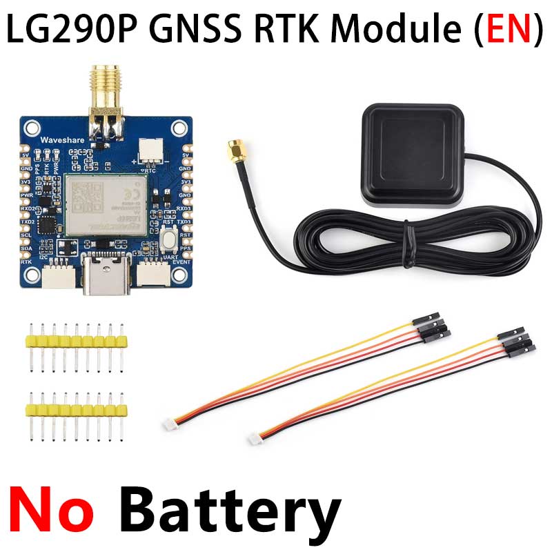
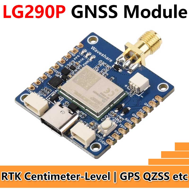
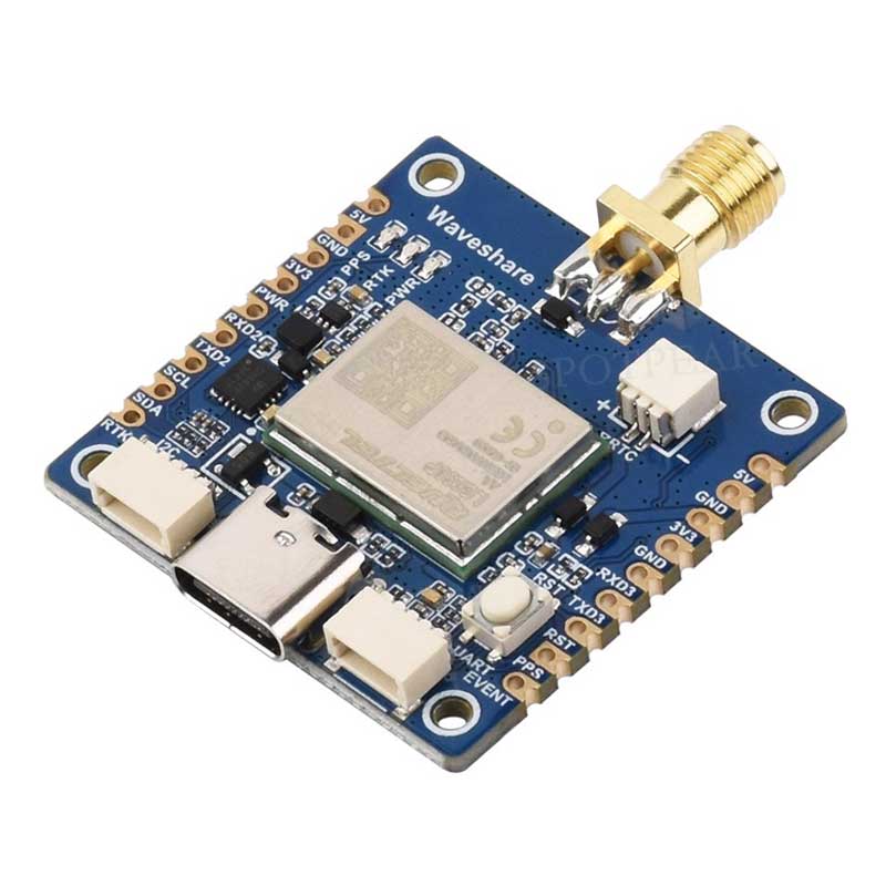
Raspberry Pi GNSS Expansion Board LG290P RTK Centimeter-Level Positioning GPS GLONASS Galileo BDS QZSS NavIC For Jetson ESP32 Arduino
$104
LG290P Series - Quad-frequency RTK Centimeter-level Positioning GNSS Expansion BoardAdopts L1+L2+L5+E6 quad-frequency positioning technologySupports concurrent reception of multiple satellite systems
RTK Centimeter-level Positioning GNSS Module
L1+L2+L5+E6 Quad-frequency Bands | RTK Centimeter-level High-precision Positioning | Raw Observation Data Output
Product Features
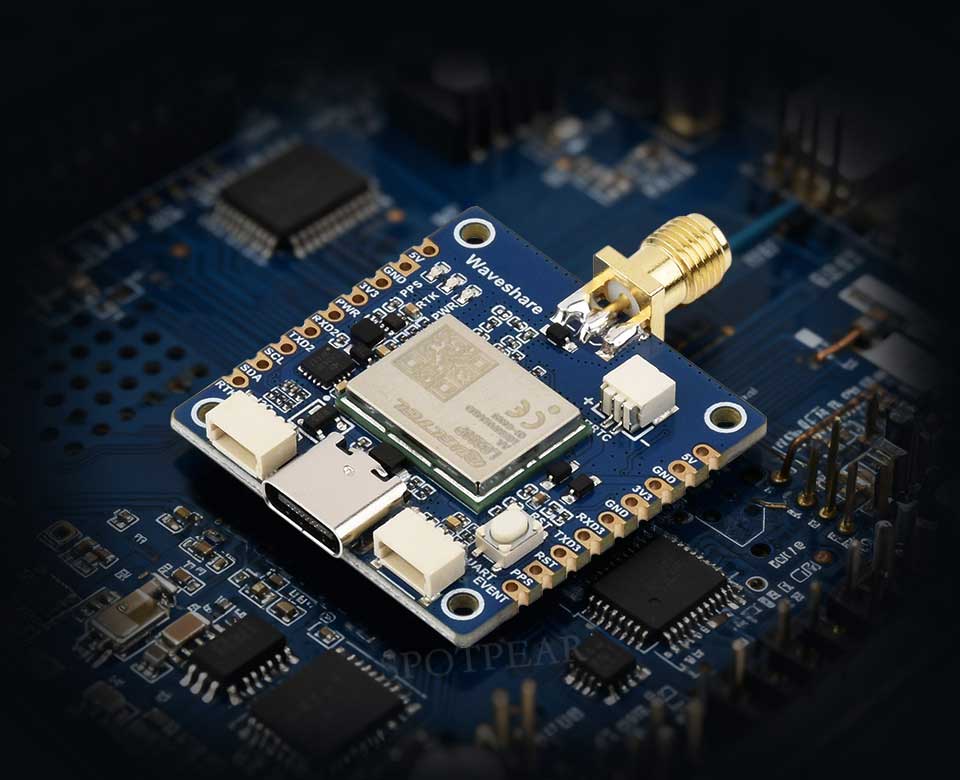
The LG290P GNSS RTK Module is a multi-constellation, quad-frequency GNSS RTK module. It tracks multi-frequency signals (L1 + L2 + L5 + E6) and is compatible with satellite systems including GPS, BDS, GLONASS, Galileo, QZSS, and NavIC.Built on a high-performance GNSS SoC architecture, the module integrates in-built interference detection and suppression algorithms. It effectively mitigates multiple narrowband interference signals, maintaining high sensitivity and strong anti-interference performance even in complex electromagnetic environments. Through multi-frequency observations and RTK real-time differential algorithms, it significantly reduces multipath errors, enabling centimeter-level high-precision positioning.Featuring a stamp hole package design, the module boasts a compact size and rich interfaces for easy embedded integration. It is an ideal choice for high-precision navigation applications such as intelligent robots, precision agriculture, mining, surveying and mapping, and autonomous driving.
- Supports multiple satellite systems including GPS / GLONASS / Galileo / BDS / QZSS / NavIC
- Supports reception of L1 + L2 + L5 + E6 quad-frequency band signals, delivering higher positioning accuracy and stronger anti-interference capability
- Centimeter-level RTK real-time differential positioning accuracy, enabling real-time reflection of the differential positioning status
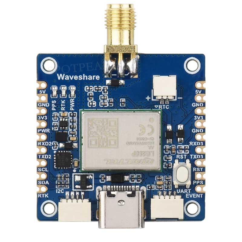
- Features a stamp hole immersion gold process design with a compact size, facilitating direct soldering or integration into devices via pin headers.
- Onboard Type-C interface supports USB-UART communication and module power supply, facilitating development and debugging.
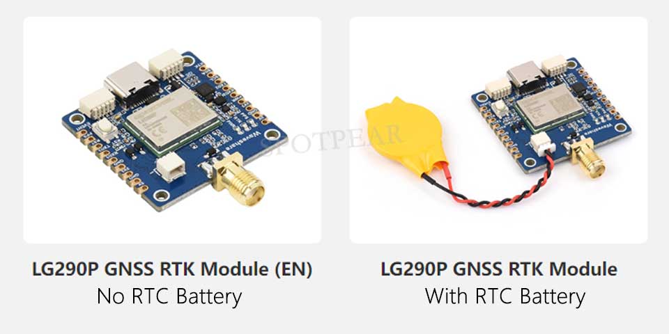
- Onboard 2PIN JST connector enables effective reduction of Time to First Fix (TTFF) when an RTC battery is connected.
- Onboard 3 LED indicators for easy monitoring of the module's operating status.
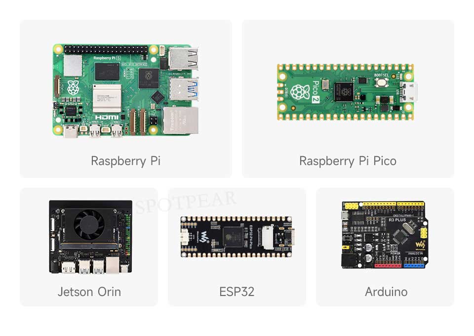
- Comprehensive supporting documentation is provided (compatible with Raspberry Pi / Raspberry Pi Pico / Jetson Orin / ESP32 / Arduino).
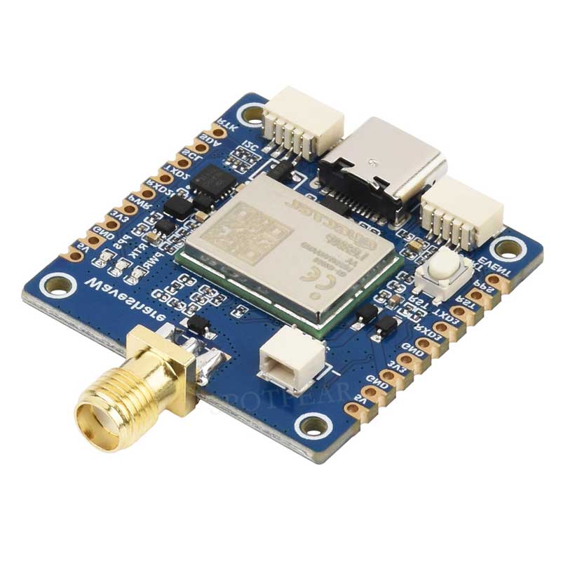
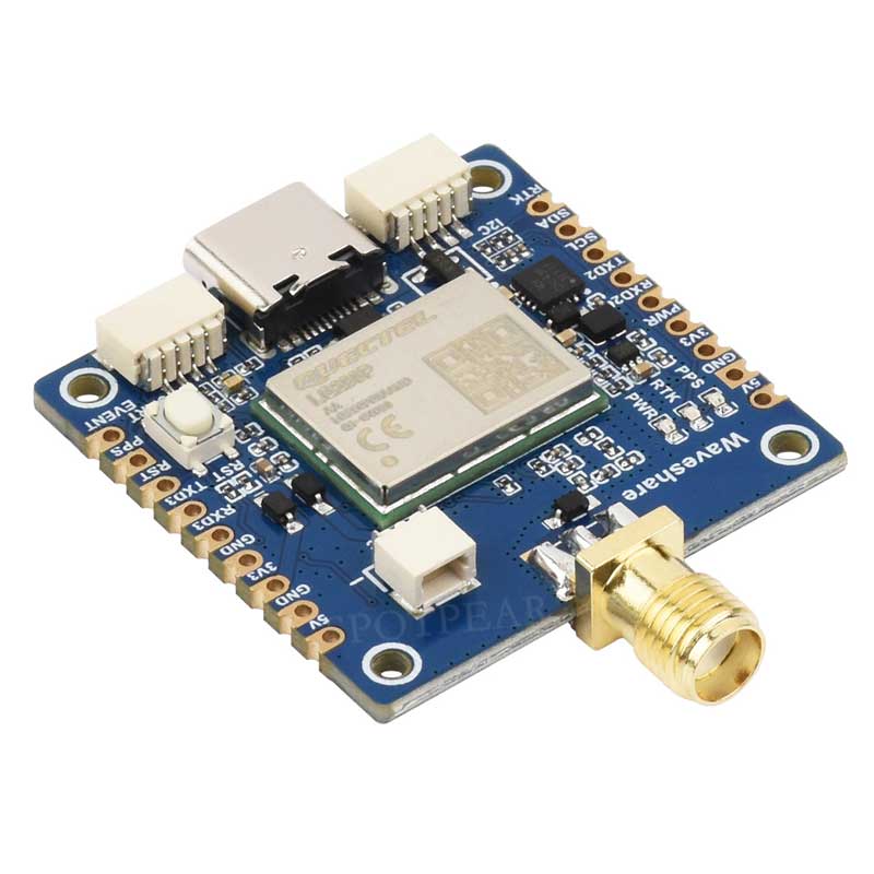
Version Selection
 Relevant Product Parameters
| Product Model | LG290P GNSS RTK Module | LC29H(AA) GPS HAT | LC29H(DA) GPS/RTK HAT | LC29H(BS) GPS/RTK HAT | ZED-F9P GPS-RTK HAT | |
|---|---|---|---|---|---|---|
| Signal Frequency Bands | GPS: L1 C/A,L1C*,L5,L2C GLONASS: L1,L2 Galileo: E1,E5a,E5b,E6 BDS: B1I,B1C,B2a,B2b,B2I,B3I QZSS: L1 C/A,L1C*,L5,L2C,L6 NavIC: L5 SBAS: L1 | GPS/QZSS:L1C/A,L5 BDS:B1I,B2a Galileo:E1,E5a GLONASS:L1 | GPS/QZSS:L1C/A,L2C BDS:B1I,B2I Galileo:E1B/C,E5a GLONASS:L1OF,L2OF | |||
| Number of Concurrent Satellite Constellations | 5 + QZSS | GPS/QZSS + BDS + Galileo + GLONASS | ||||
| SBAS | WAAS、EGNOS、BDSBAS、MSAS、GAGAN 和 SDCM | WAAS、EGNOS、MSAS 和 GAGAN | - | WAAS、EGNOS、MSAS 和 GAGAN | ||
| RTK Function | RTK Rover and Base | - | RTK Rover | RTK Base | RTK Rover and Base | |
| Positioning Accuracy | PVT | 0.7m CEP | 1m CEP | - | 1.5m CEP | |
| RTK | 0.8cm + 1ppm CEP | - | 0.01m + 1ppm CEP | - | 0.01m + 1ppm CEP | |
| Update Rate | PVT | Default:10Hz Max.:20Hz | 1~10Hz | - | 1~10Hz | |
| RTK | - | 1Hz | - | 1~8Hz | ||
| RAW | 1Hz | 1~20Hz | ||||
| RTK Convergence Time (Tested in Open Outdoor Environments) | <5s | - | <10s | - | <10s | |
| Time to First Fix (AGNSS Disabled) | Cold Start | 28s | 26s | - | 24s | |
| Warm Start | 1.7s | 1s | - | 2s | ||
| Hot Start | 28s | 16s | - | 2s | ||
| Time to First Fix (TTFF) (EASY Enabled) | - | 2s | - | |||
| Time to First Fix (TTFF) (AGNSS Enabled) | Cold Start | - | 5s | - | TBD | |
| Warm Start | - | 5s | - | TBD | ||
| Assisted Start | - | 5s | - | TBD | ||
| Sensitivity | Tracking and Navigation | -160dBm | -165dBm | -167dBm | ||
| Reacquisition | -155dBm | -159dBm | -157dBm | -159dBm | -160dBm | |
| Cold Start | -146dBm | -147dBm | -145dBm | -147dBm | -148dBm | |
| Velocity Accuracy | 0.03m/s | 0.2m/s | - | 0.05m/s | ||
| PPS Accuracy | 5ns | 20ns | - | 30ns | ||
| Dynamic Performance | Acceleration (Max):4g | |||||
| Altitude (Max):10000m | Altitude (Max):50000m | |||||
| Velocity (Max):490m/s | Velocity (Max):500m/s | |||||
| Communication Interface | USB,UART (4800~ 921600bps 460800bps) | UART (9600~3000000bps 115200bps), I2C (Max 400KHz) | USB,UART (4800~921600bps 9600bps),I2C (Max 400KHz),SPI (5MHz) | |||
| Communication Protocol | NMEA 0183/RTCM 3.x | NMEA 0183 V4.10,RTCM 3.x | NMEA 0183 V4.10,UBX,RTCM 3.3 | |||
| Supply Voltage | 5V | |||||
| Total Device Current Consumption | 小于 100mA@5V (Continue) | 小于 40mA@5V (Continue) | 小于 120mA@5V (Continue) | |||
| Operating Temperature | -40~85℃ | |||||
| Product Dimensions | 33 × 33 (mm) | 65 × 30.5 (mm) | ||||
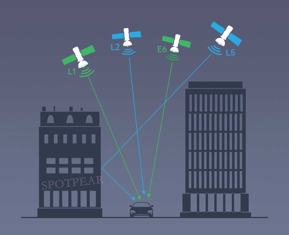
Quad-band L1 + L2 + L5 + E6 Positioning Technology
Supports simultaneous tracking of multi-band satellite signals including L1 + L2 + L5 + E6
Reduces multipath effects in urban canyons and improves positioning accuracy
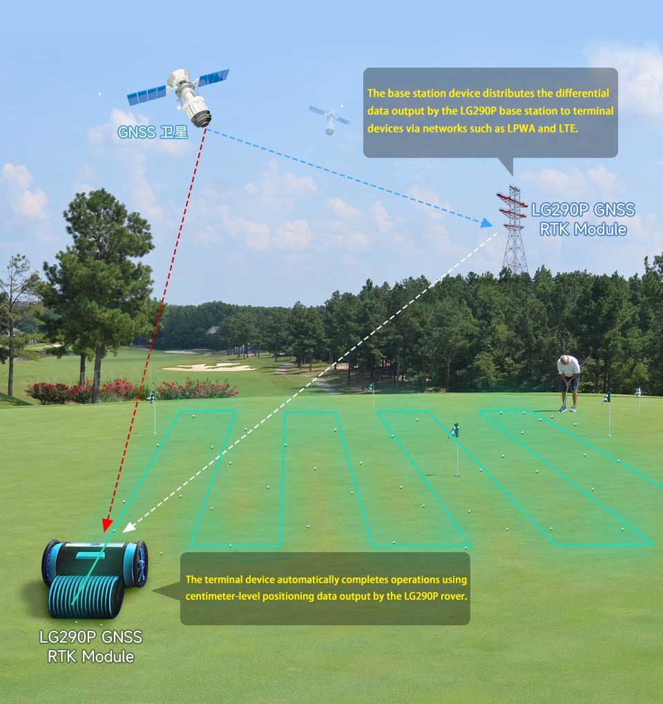
RTK Rover, RTK Base Station Centimeter-Level Positioning
Two LG290P GNSS RTK Modules are used as the RTK base station and rover respectively。
Either set up a continuously operating reference base station using the LG290P module configured in base station mode at a ground location with known fixed coordinates, or purchase RTK ground-based augmentation services. GNSS correction values are sent via the network to the LG290P rover that has uploaded rough positioning information, and the terminal device—affected by errors such as multipath refraction—performs real-time error calculation to achieve centimeter-level positioning within seconds.
Supports concurrent reception of multiple satellite systems
Supports GPS, BDS, GLONASS, Galileo, QZSS, and NavIC, while the system maintains low power consumption

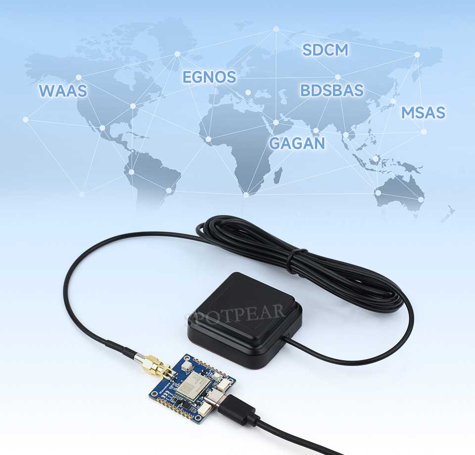
Supports the SBAS Satellite-Based Augmentation System
It enables multi-satellite augmented positioning and real-time error correction, significantly improving positioning accuracy and reliability in complex environments. This product supports augmentation systems such as WAAS, EGNOS, BDSBAS, MSAS, GAGAN, and SDCM.
Compact and easy to integrate
Adopting a stamp hole design, it features a compact size, high integration, and brings out most commonly used pin interfaces, facilitating DIY and embedded integration into users' devices
Suitable for multiple programming platforms
Provides example programs and user manuals for Raspberry Pi / Raspberry Pi Pico / Jetson Orin / ESP32 / Arduino, enabling easier development and integration with strong expandability
Application Scenarios
Intelligent Robots, Precision Agriculture, Mining, Surveying and Mapping, Autonomous Driving

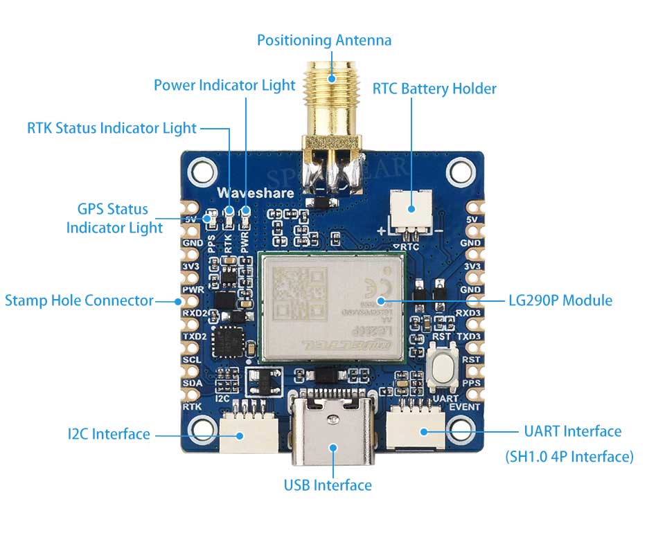
Resource Overview
The I2C interface function is still under development, and I2C communication is not supported temporarily.
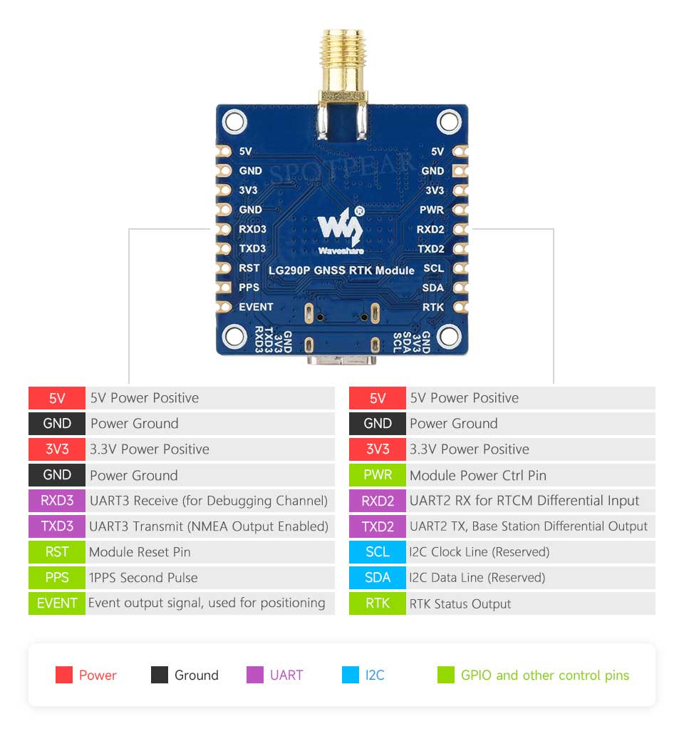
Interface Definition
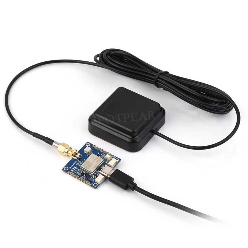
Hardware Connection Reference
Direct USB connection to PC / Raspberry Pi / Jetson Orin series motherboards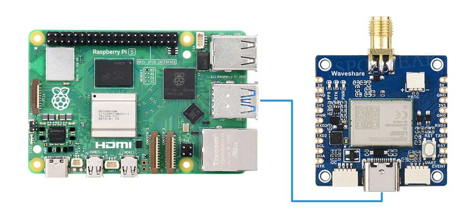
UART pin header or SH1.0 4PIN connector for Raspberry Pi Pico connection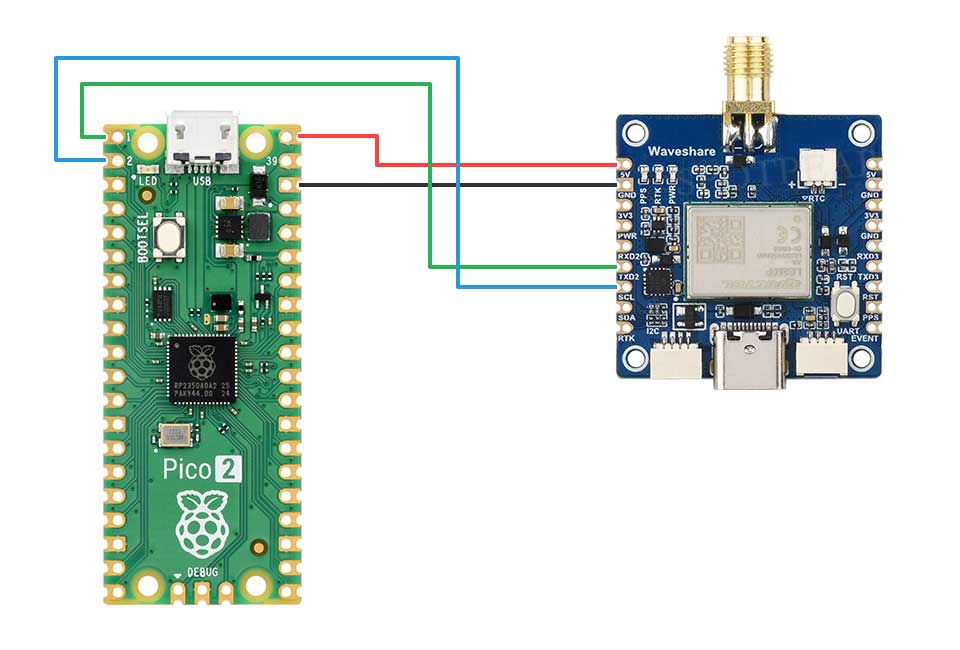
UART pin header or SH1.0 4PIN connector for ESP32 and other motherboards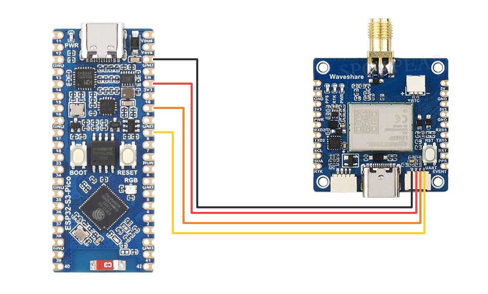
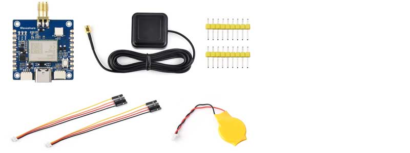
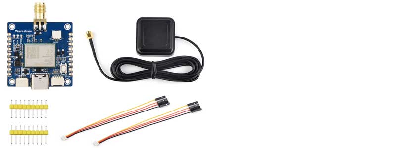
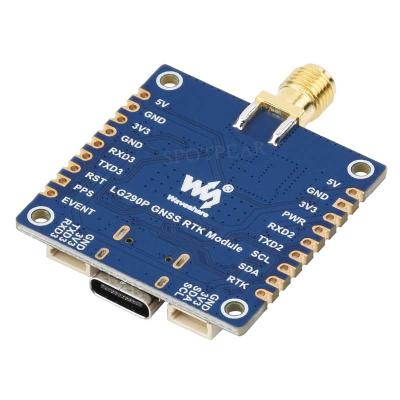
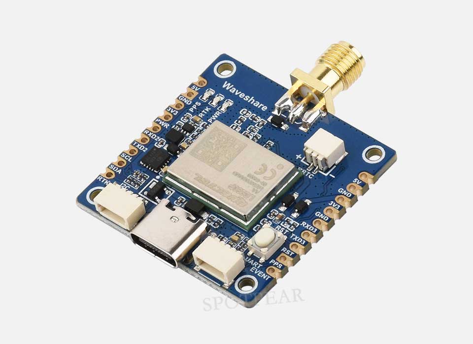
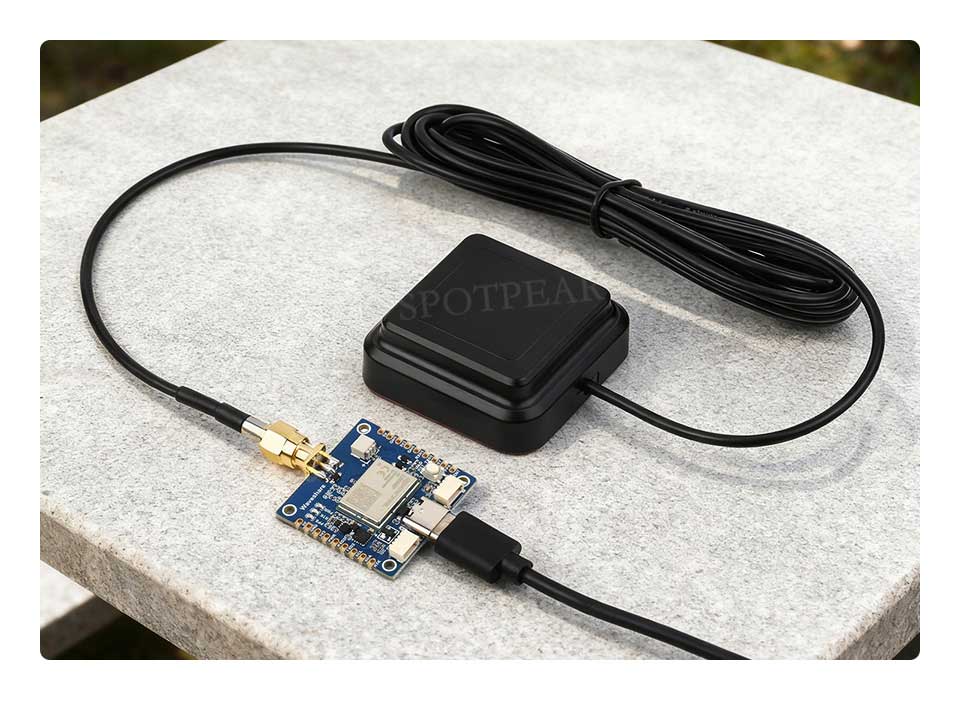
Product Display
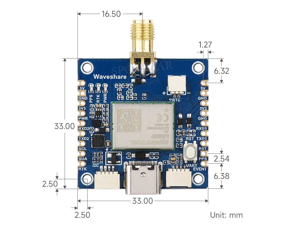
Product Dimensions